Méréville (kantón)
Méréville je francúzsky kantón v departemente Essonne v regióne Île-de-France. Vznikol 22. júla 1967.
| Méréville | |||
| kantón | |||
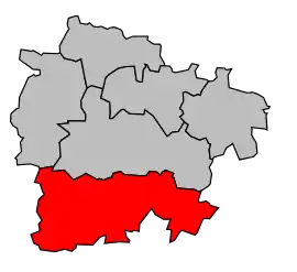 Kantón na mape obvodu Étampes | |||
| Štát | |||
|---|---|---|---|
| Región | Île-de-France | ||
| Departement | Essonne | ||
| Obvod | Étampes | ||
| Súradnice | 48°21′02″S 2°09′03″V | ||
| Správne sídlo | Méréville | ||
| Rozloha | 232,19 km² (23 219 ha) | ||
| Obyvateľstvo | 15 987 (2011) [1] | ||
| Hustota | 68,85 obyv./km² | ||
| Časové pásmo | SEČ (UTC+1) | ||
| - letný čas | SELČ (UTC+2) | ||
| INSEE | 9117 | ||
| Počet obcí | 22 | ||
| Portál, ktorého súčasťou je táto stránka: | |||
Zloženie kantónu
| Obec | Počet obyvateľov (2008) |
PSČ | INSEE |
|---|---|---|---|
| Abbéville-la-Rivière | 285 | 91150 | 91 1 17 001 |
| Angerville | 3392 | 91670 | 91 1 17 016 |
| Arrancourt | 132 | 91690 | 91 1 17 022 |
| Blandy | 123 | 91150 | 91 1 17 067 |
| Bois-Herpin | 75 | 91150 | 91 1 17 075 |
| Boissy-la-Rivière | 521 | 91690 | 91 1 17 079 |
| Brouy | 123 | 91150 | 91 1 17 112 |
| Chalou-Moulineux | 403 | 91740 | 91 1 17 131 |
| Champmotteux | 360 | 91150 | 91 1 17 137 |
| Congerville-Thionville | 220 | 91740 | 91 1 17 613 |
| Estouches | 207 | 91660 | 91 1 17 222 |
| Fontaine-la-Rivière | 207 | 91690 | 91 1 17 240 |
| Guillerval | 745 | 91690 | 91 1 17 294 |
| La Forêt-Sainte-Croix | 152 | 91150 | 91 1 17 248 |
| Marolles-en-Beauce | 220 | 91150 | 91 1 17 374 |
| Méréville | 3187 | 91660 | 91 1 17 390 |
| Mespuits | 170 | 91150 | 91 1 17 399 |
| Monnerville | 400 | 91930 | 91 1 17 414 |
| Pussay | 1847 | 91740 | 91 1 17 511 |
| Roinvilliers | 88 | 91150 | 91 1 17 526 |
| Saclas | 1797 | 91690 | 91 1 17 533 |
| Saint-Cyr-la-Rivière | 494 | 91690 | 91 1 17 544 |
Referencie
- Populations légales 2011 (xls, 8,12 MB)
Zdroj
Tento článok je čiastočný alebo úplný preklad článku Kanton Méréville na českej Wikipédii.

This article is issued from Wikipedia. The text is licensed under Creative Commons - Attribution - Sharealike. Additional terms may apply for the media files.