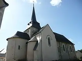
Saint-Quentin-lès-Beaurepaire
Saint-Quentin-lès-Beaurepaire je francúzska obec, ktorá sa nachádza v departemente Maine-et-Loire, v regióne Pays-de-la-Loire.
| Saint-Quentin-lès-Beaurepaire | |||
| obec | |||
 | |||
| Štát | |||
|---|---|---|---|
| Región | Pays-de-la-Loire | ||
| Departement | Maine-et-Loire | ||
| Obvod | Saumur | ||
| Kantón | Baugé | ||
| Súradnice | 47°37′38″S 0°6′28″Z | ||
| Najvyšší bod | |||
| - výška | 66 m n. m. | ||
| Najnižší bod | |||
| - výška | 31 m n. m. | ||
| Rozloha | 7,51 km² (751 ha) | ||
| Obyvateľstvo | 297 | ||
| Hustota | 39,55 obyv./km² | ||
| Časové pásmo | SEČ (UTC+1) | ||
| - letný čas | SELČ (UTC+2) | ||
| PSČ | 49150 | ||
| INSEE | 49315 | ||
 Poloha obce Saint-Quentin-lès-Beaurepaire Poloha obce Saint-Quentin-lès-Beaurepaire
| |||
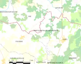 Mapa obce Saint-Quentin-lès-Beaurepaire Mapa obce Saint-Quentin-lès-Beaurepaire
| |||
| Wikimedia Commons: Saint-Quentin-lès-Beaurepaire | |||
| Webová stránka: http://www.saintquentinlesbeaurepaire.fr/ | |||
| Portály, ktorých súčasťou je táto stránka: | |||
Poloha
Obec má rozlohu 7,51 km². Najvyšší bod je položený 66 m n. m. a najnižší bod 31 m n. m.[1]
Obyvateľstvo
Počet obyvateľov obce je 297 (2011)[2].
Nasledujúci graf zobrazuje vývoj počtu obyvateľov v obci.
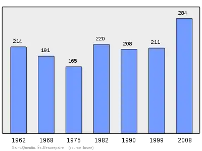
Zdroje: INSEE[3]
Referencie
- Répertoire Géographique des Communes [online]. Institut national de l'information géographique et forestière (IGN). Dostupné online. (po francúzsky)
- Populations légales 2009 [online] Institut national de la statistique et des études économiques (Insee). Dostupné online. (po francúzsky)
- Résultat du recensement de la population 2008 [online] Institut national de la statistique et des études économiques (Insee). Dostupné online. (po francúzsky)
This article is issued from Wikipedia. The text is licensed under Creative Commons - Attribution - Sharealike. Additional terms may apply for the media files.