Agnicourt-et-Séchelles
Agnicourt-et-Séchelles je francúzska obec, ktorá sa nachádza v departemente Aisne v regióne Pikardia.
| Agnicourt-et-Séchelles | |||
| obec | |||
 | |||
| Štát | |||
|---|---|---|---|
| Región | Pikardia | ||
| Departement | Aisne | ||
| Súradnice | 49°42′59″S 3°57′12″V | ||
| Najvyšší bod | |||
| - výška | 175 m n. m. | ||
| Najnižší bod | |||
| - výška | 96 m n. m. | ||
| Rozloha | 10,79 km² (1 079 ha) | ||
| Obyvateľstvo | 200 | ||
| Hustota | 18,54 obyv./km² | ||
| Časové pásmo | SEČ (UTC+1) | ||
| - letný čas | SELČ (UTC+2) | ||
| PSČ | 02340 | ||
| INSEE | 02004 | ||
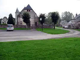
 Poloha obce Agnicourt-et-Séchelles Poloha obce Agnicourt-et-Séchelles
| |||
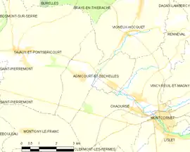 Mapa obce Agnicourt-et-Séchelles Mapa obce Agnicourt-et-Séchelles
| |||
| Wikimedia Commons: Agnicourt-et-Séchelles | |||
| Portály, ktorých súčasťou je táto stránka: | |||
Polohopis
Agnicourt-et-Séchelles má rozlohu 10,79 km². Najvyšší bod je položený 175 m n. m. a najnižší bod 96 m n. m.[1].
Obyvateľstvo
Agnicourt-et-Séchelles má 200 obyvateľov (2009)[2].
Graf vývoja obyvateľstva:
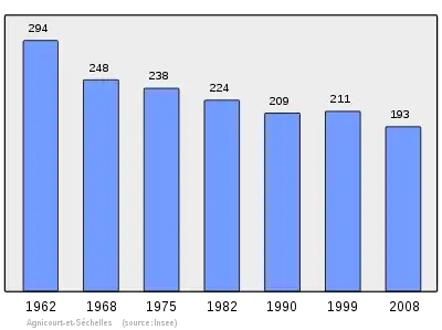
Zdroje: INSEE[3]
Referencie
- Répertoire Géographique des Communes [online]. Institut national de l'information géographique et forestière (IGN). Dostupné online. (po francúzsky)
- Populations légales 2009 [online] Institut national de la statistique et des études économiques (Insee). Dostupné online. (po francúzsky)
- Résultat du recensement de la population 2008 [online] Institut national de la statistique et des études économiques (Insee). Dostupné online. (po francúzsky)
This article is issued from Wikipedia. The text is licensed under Creative Commons - Attribution - Sharealike. Additional terms may apply for the media files.